ALBERT J. SOUSA CAMBRIDGE WOODLANDS CARLSON WOODS CONNOR MILL TRAIL FOWLER BOG FREEDOM FOREST GREAT FARM BROOK GREAT MOOSE WETLAND KANOKOLUS BOG MOULTON’S MILL PLEASANT LAKE
RICHARDSON MEMORIAL PRESERVE RINES WETLANDS & WILDLIFE PRESERVE WESLEY ROAD WETLAND
MOULTON'S MILL


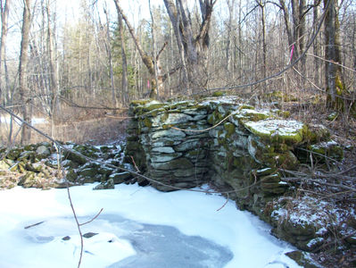
Encompassing two miles of 25-Mile Stream shoreline, the 700-acre Moulton's Mill Preserve offers the opportunity to immerse yourself in the Central Maine woods! Enjoy hunting, fishing, berry picking, paddling, birding or snowshoeing. A hand-carry boat launch is located at the eastern most preserve parking area on Route 139, as is a short-trail to the old mill site. The parcel on the eastern shore is best accessed by water. The western parcel is accessible from Route 139 along an old woods road that starts at the information kiosk visible from the road just west of 25 Mile Stream. This trail provides a nice walk along the stream.
In 2021 a trail extension from the Rine Preserve was added to connect to a trail which travels north along another old woods road starting at the north end of the hayfield. This trail loops and then meets the stream trail originating at the kiosk at 25 Mile Stream. Be aware that there are wet areas during wet seasons, so rubber boots or waterproof footwear are recommended. Another trail addition connects the boat launch lot to the 25 Mile Stream trail and the rest of the trail system. Some of these additions remain in a fairly primitive state so be prepared for rough going!
The two properties that comprise the Moulton's Mill Preserve were acquired with support from the Maine Natural Resource Conservation Program.
Directions to Moulton's Mill Preserve from Unity center:
Drive west on to Route 139 towards Waterville. Travel 2.25 miles and look for the preserve sign and parking area
entrance on the right. Visitors may also park on the wide shoulder of Route 139 when visiting the western parcel. There is also a parking lot across the street further west at our Rines Preserve on the south side of Rt 139. Future plans include additional parking east of the boat launch lot.


